") A 3.1 magnitude earthquake was reported in southern Illinois, roughly 100 miles south of Springfield. (U.S. Geological Survey)
A 3.1 magnitude earthquake was reported in southern Illinois, roughly 100 miles south of Springfield. (U.S. Geological Survey)
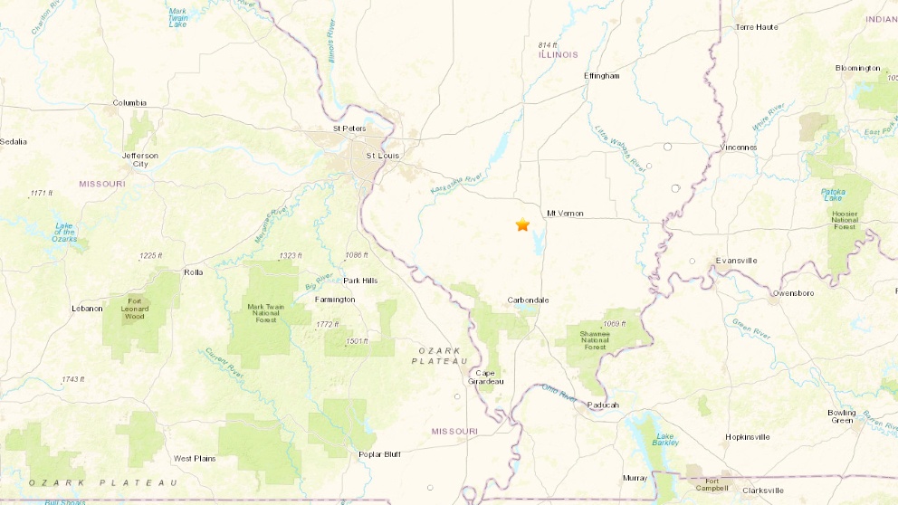
A 3.1 magnitude earthquake rocked southern Illinois late Sunday — the second significant tremor reported in the state in the past two months, according to the U.S. Geological Survey.
This latest seismic activity was centered near the small town of Waltonville (population 432), roughly 110 miles south of Springfield.
USGS is still gathering information on the quake and is asking anyone who felt it to fill out a form online.
") (U.S. Geological Survey)
(U.S. Geological Survey)
While earthquakes are rare east of the Rocky Mountains, Illinois sits within two "hot spots" for quakes in the central U.S.
One is the New Madrid Seismic Zone, which spans the central Mississippi Valley from Cairo, Illinois, through southeastern Missouri, western Kentucky, western Tennessee and northeast Arkansas. This area has been the site of some of the largest earthquakes in North America, according to the state of Illinois.
The Waltonville quake lies within the Illinois Basin-Ozark Dome Region, which borders the New Madrid Zone and spans parts of Arkansas, Missouri, Illinois, Indiana and Kentucky.
According to USGS, "moderately damaging earthquakes strike somewhere in this region each decade or two." The largest historical earthquake in this region was a 5.4 magnitude in southern Illinois in 1968.
Few earthquakes in the region can be linked to named faults (unlike the New Madrid), with numerous smaller or deeply buried faults remaining undetected by scientists, USGS said.
Contact Patty Wetli: @pattywetli | (773) 509-5623 | [email protected]
")
")
")
")
")
")
