(CNN) — Powerful tornadoes and storms swept through southwestern Michigan Tuesday evening, destroying homes and businesses and injuring several residents, scenes that could play out once again in the central and eastern U.S. Wednesday.
Here’s the latest on the destruction in Michigan and ongoing storms:
• Mobile home park struck by tornado: More than a dozen people were injured at a mobile home park in Pavilion Township in Kalamazoo County, Michigan, following a tornado Tuesday, according to a city official. Fifteen to 20 people had minor injuries and were transported to two area hospitals, according to the county’s emergency management spokesperson Andrew Alspach.
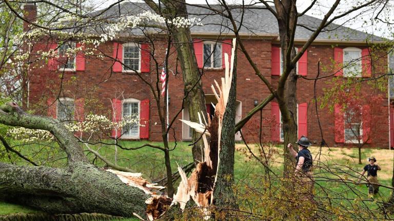
• One Michigan town may have been hit twice: At least one tornado, possibly two, hit Portage Tuesday evening, as the area faced two tornado warnings in just over an hour, the National Weather Service said. Homes and businesses in the city sustained significant damage, but there were no serious injuries, according to town officials. A tornado ripped a large hole into a FedEx facility. Downed wires nearby trapped about 50 people in the facility for a few hours, a spokesperson for the Kalamazoo County administrator’s office, told MLive.com.
• Damage reported in at least two other Michigan counties: Multiple homes and businesses were destroyed after a possible tornado touched down in Centreville on Tuesday, according to St. Joseph County Undersheriff Jason Bingaman. The storm damage ripped off roofs and flattened homes “completely down,” Bingaman told CNN. At least seven homes were destroyed in nearby Branch County, according to Emergency Management Director Tim Miner.
First-ever tornado emergency in Michigan: Parts of Branch County, including Union City, were placed under Michigan’s first tornado emergency when “a large and destructive tornado” was over the area Tuesday, according to the National Weather Service. Tornado emergencies are the most extreme form of a tornado warning and are only issued when a tornado threatens catastrophic damage and loss of life, often in a populated area.
• Chaotic severe weather stretch: April to June is the most active time for tornadoes in the US, and May is typically the busiest month. This year has been no exception. At least one tornado has been reported in the US every day since April 25 – a streak of 13 days and counting. Nearly 300 tornado reports – at least two of which were confirmed EF4s – were submitted in that time span, according to the Storm Prediction Center.
Homes are left damaged after a tornado at Pavilion Estate Mobile Home Park in Kalamazoo County, Michigan, on May 7, 2024. (Credit: Chicago & Midwest Storm Chasers via CNN Newsource)
Tornado Threat Continues Wednesday
Nearly 4 million people are under a Level 4 of 5 risk of severe thunderstorms Wednesday, according to the Storm Prediction Center. Within this risk are parts of Missouri, Illinois, Kentucky and Tennessee — including Nashville.
An additional 50 million people from Texas, through much of the Ohio Valley and into the mid-Atlantic, are under a Level 2 of 5 or Level 3 of 5 risk.
Severe storms started to bubble to life around sunrise in parts of eastern Kansas. These storms will expand in scope and strength through the morning and push into parts of Missouri. This morning activity will heavily influence how the rest of the day unfolds.
If morning storms form into a powerful and organized line, damaging winds will be the biggest threat into the afternoon hours. Hail and tornadoes will also be possible. If this organized line doesn’t form, the threat for individual storms to produce strong tornadoes – at least EF2 strength – will increase.
Parts of Missouri, Illinois, Indiana, Kentucky and Tennessee face the greatest risk of strong tornadoes, especially from the afternoon onward.
Additional storms will fire up from the Southern Plains to the mid-Atlantic throughout the afternoon. Storms capable of the strongest winds and largest hail are most likely from Texas to Kentucky and Tennessee, but any storm could unload damaging wind gusts and hail up to the size of softballs.
Some areas may encounter an initial round of severe storms early Wednesday only to be hit with another round later in the day. Tennessee is a prime example. Additional severe weather is likely after thunderstorms unleashed hail, damaging winds and triggered multiple tornado warnings Wednesday morning.
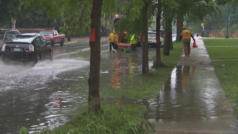
The repeated rounds of storms Wednesday will also deliver torrential rainfall and raise the risk of flooding.
“The greatest flash flooding threat also overlaps with the risk of severe thunderstorms, centered over Kentucky and Tennessee as well sections of neighboring states,” the National Weather Service said. A Level 3 of 4 risk of flooding rainfall is in place here, according to the Weather Prediction Center.
Rainfall rates could reach 2 inches per hour, which could dramatically increase the possibility of flash flooding. Locations worked over by multiple heavy storms could record more than 4 to 5 inches of rain.
The-CNN-Wire™ & © 2024 Cable News Network, Inc., a Warner Bros. Discovery Company. All rights reserved.

