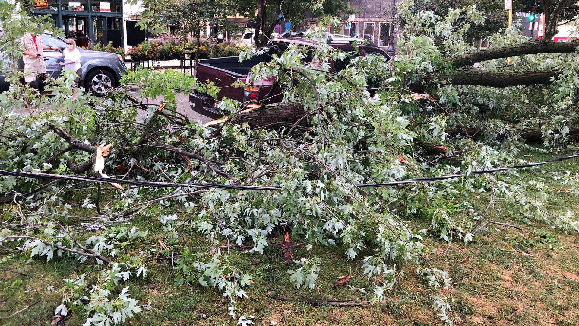
") Nearly 12,000 trees were lost during the powerful derecho storm in Chicago on Aug. 10, 2020. (Patty Wetli / WTTW News)
Nearly 12,000 trees were lost during the powerful derecho storm in Chicago on Aug. 10, 2020. (Patty Wetli / WTTW News)
(CNN) — The Midwest, including most of Wisconsin, will be at risk from possible tornadoes, strong storms and hurricane-force winds Wednesday as the region is under a level 4 out of 5 threat of severe weather.
“A favorable pattern will exist over Minnesota/Wisconsin toward Lake Michigan today, supporting intense severe thunderstorms and possible derecho development later this afternoon/evening,” said the Storm Prediction Center.
To be called a derecho, severe storms must have winds in excess of 58 mph and cause damage spanning at least 250 miles. The resulting conditions can be described as a tropical storm over land. National Oceanic and Atmospheric Administration climatologist Adam Smith described a 2020 derecho to CNN Weather as an inland-hurricane, with winds reports in excess of 100 mph and hurricane-force winds lasting for up to 45 minutes.
The severe threat will start in eastern Minnesota in the afternoon, pushing through Wisconsin in the evening hours.
The atmosphere will be primed for storms thanks to high dew points and heating during the day before a cold front from the Dakotas pushes into the area igniting severe storms.
Initial strong supercells — individual storms — are possible in the afternoon across parts of Minnesota and Wisconsin, bringing the risk for tornadoes and very large hail. Storms will grow and join together creating a line of strong winds, possibly over hurricane strength of 74 mph, causing widespread damage and power outages to the region.
“Given the degree of instability and strong flow aloft, the development of a derecho is certainly possible with widespread wind damage caused by hurricane-force winds. Some tornadoes may also accompany the line,” National Weather Service in Twin Cities, Minnesota, said.
The damaging wind event could impact a wide swath of the Midwest, bringing dangerous conditions late at night.
“The greatest impact is expected in Wisconsin but a large area of the Midwest is at risk, including Minneapolis, Milwaukee, and Chicago,” said CNN meteorologist Dave Hennen.
The storms will progress from eastern Minnesota to the southeast throughout the evening and late night hours, reaching Michigan and Illinois in the overnight into the early morning.
Torrential rainfall is expected with the storms, creating dangerous driving conditions. Luckily these storms will be moving very quickly, minimizing the flash flood threat.
The WPC has issued a slight risk for excessive rainfall over the region where up to 2.5 inches of rainfall is possible.
“The progressive nature of the convection should mitigate the flooding threat a bit, though localized urban flooding will likely occur,” the NWS in Green Bay, Wisconsin, said.
Derechos, the costliest type of severe storms
Derechos are extremely costly and dangerous wind events. They are defined as widespread and long-lived wind events that cause damage like a tornado but in a single direction. Damage caused by derechos is frequently referred to as straight-line wind damage.
In August 2020, a severe thunderstorm event impacted the Midwest as a derecho and produced severe wind damage across Nebraska, Iowa, Illinois, Wisconsin and Indiana.
Its $11 billion in damage places the derecho among the top three costliest severe storm events ever, joining two major tornado outbreaks in 2011 (tropical cyclones are ranked separately from severe storms). That April, over 300 tornadoes ripped through the Southeast, including an EF-5 tornado that hit northern Alabama and killed 78 people.
Over 150 tornadoes were recorded that May, notably the EF-5 tornado that killed 160 people in Joplin, Missouri.
The 2020 derecho event caused widespread power outages and devastating tree and crop damage. More than 20 million people were impacted by the storms covering an area of 90,000 square miles. In Iowa and Illinois alone over 1 million people were left without power.
“The strongest estimated wind speeds in the vicinity of Cedar Rapids, Iowa, were among the highest wind speeds ever recorded during a derecho event, peaking at about 140 mph,” the NWS said. “The storm system also produced 26 weak tornadoes in Iowa, Wisconsin, Illinois, and Indiana, although damage from the tornadoes was similar in magnitude to that caused by the straight-line winds covering a much larger area.”
The-CNN-Wire
™ & © 2021 Cable News Network, Inc., a WarnerMedia Company. All rights reserved.
")
")
")
")
")
")
