We all know Chicago as the city of neighborhoods, but how exactly are those neighborhoods defined? And do those boundaries last mapped out in the 1920s still hold true?
That’s what a group of scholars and researchers from the University of Chicago is venturing to find out.
They’re asking residents to weigh in and draw their own neighborhood boundaries through an interactive map survey.
Lydia Wileden, a postdoctoral scholar at the University of Chicago, is helping lead the Neighborhood Mapping Project.
“We’re really interested in thinking about how people in Chicago actually experience their neighborhood,” Wileden said. “We have the Chicago area map defined in the 1920s, but we know that that really doesn’t map on to how people actually experience their communities.”
The New York Times recently launched a similar project, which inspired Wileden and her colleagues to do the same for Chicago.
“They got about 37,000 responses from their readers, so we are feeling a little competitive and hoping to learn directly from Chicago residents what they think about their neighborhood,” Wileden added.
Chicago is made up of 77 community areas, but then has different neighborhoods that fall within that. Still, there’s a lot of variation that’s not clearly defined.
“The 77 (community areas) are large, they’re unchanging,” Wileden said. “They really gloss over a lot of the variation that exists in Chicago. There is the 1978 city neighborhood map that the city accepted in the 1990s and that recognizes about 280 neighborhoods, I believe. But missing from that map are our neighborhoods like Bronzeville. That map includes neighborhoods like Pilsen that aren’t community areas, similarly Wicker Park.”
Chicago historian Shermann “Dilla” Thomas said it’s refreshing to hear that work is being done about these decades-old maps.
“Historically, the boundaries of neighborhoods and community areas and sometimes even the names, they’re not really rooted in the best of historical spaces,” Dilla said. “Sometimes the boundaries between two neighborhoods are actually formally the boundaries of the restrictive racial covenants that divided us as a city. So it’s really, really good to hear that something’s been done.”
Despite Chicago’s communities experiencing change over the years, Dilla said people still closely identify with their communities and where they’re from.
“People in Rosemoor are often saying that they don’t feel seen because we don’t talk about Rosemoor, we talk about Roseland,” Dilla said. “People from Englewood discussed not really feeling seen as well because of some of the disinvestment. … When you run into people from Chicago, there’s two ways we identify each other. We identify each other based off of the high school that we went to and then based off of the neighborhood that you grew up in. So what neighborhood you’re from speaks volumes to the type of Chicagoan that you are.”
Wileden’s team has received more than 4,000 maps that people have drawn of their neighborhood boundaries in the past month, but is currently seeking more input from priority zip codes, mainly on the South and West sides, based on low response numbers.
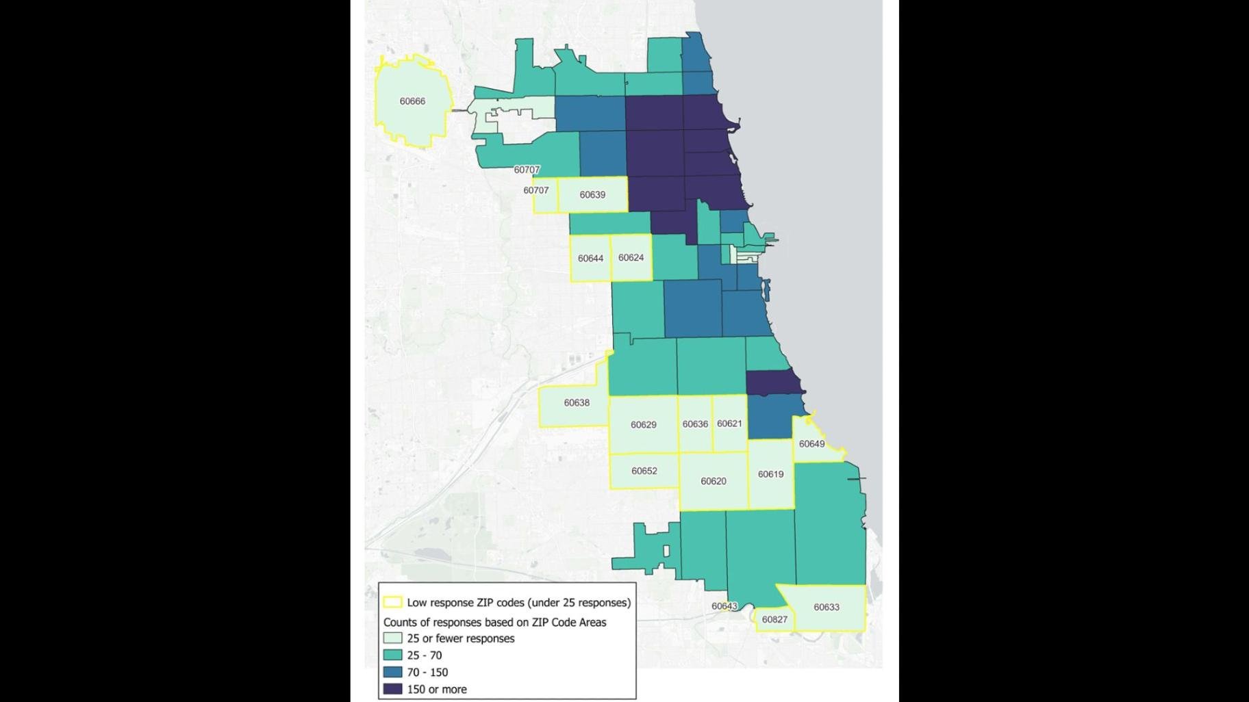 Wileden’s team is seeking more input from priority zip codes, mainly on the South and West sides, based on low response numbers. (Provided)
If you’d like to weigh in on your own Chicago neighborhood, visit the survey at chicago-neighborhoods.com.
Contact Acacia Hernandez: @acacia_rosita | [email protected]


